The Dniester River Basin, an ecological and economic jewel, stretches through the heart of Eastern Europe, touching the lives and livelihoods of millions across Moldova, Poland, and Ukraine.
This overview looks into the basin’s diverse aspects, ranging from its vital role in water supply and industrial activities to its rich natural ecosystems and conservation efforts.
As we explore the basin’s population dynamics, economic environment, geographic conditions, land use, water reservoirs, and the various ways in which the Dniester’s resources are utilized, we gain a deeper understanding of its significance
Population
The Dniester Basin, a vital water source, sprawls across three nations: Moldova, Poland, and Ukraine. Encompassing a total length of 1,362 km, the Dniester River flows primarily within Ukraine (705 km) and Moldova (437 km), with a shared section of 220 km between these two countries. Poland hosts a small segment of the Strviazh River, a left tributary.
Geographically, the basin touches seven Ukrainian oblasts (Lviv, Ivano-Frankivsk, Chernivtsi, Ternopil, Khmelnytskyi, Vinnytsia, and Odessa), claiming 13% to 80% of their areas. In Moldova, it extends over 59% of the country, including 19 districts and the Transnistria region.
Key Facts:
- Towns and Townships: The Ukrainian part houses 62 towns and 95 townships, while the Moldovan section includes 2 municipalities and 41 towns.
- Population: Over 7 million people reside within the basin in Ukraine and Moldova, with 5 million in Ukraine and 2.74 million in Moldova.
- Water Supply: The Dniester is crucial for drinking water, servicing not just the basin’s population but also an additional 3.5 million people in Chernivtsi and Odessa.
The Dniester’s significance cannot be overstated, serving as the primary drinking water source for Moldova and a crucial resource for many in Ukraine. Its role in supporting the livelihoods and wellbeing of millions highlights the importance of sustainable management and conservation efforts.
Economic Environment
The Dniester Basin’s diverse natural landscape and economic demands have fostered the growth of multiple industries. These include power, oil and gas, coal, chemicals, forestry, woodworking, and food production. The basin’s lowland areas are particularly conducive to agricultural activities.
In Ukraine, the basin underpins a robust and varied economy. This includes industries known for their environmental impact, predominantly situated in the upper part of the basin (in Lviv and Ivano-Frankivsk Oblasts). Here, the Dniester River gathers 70% of its total flow, underscoring the region’s significance.
Key Points:
- Industrial Presence: Ukraine’s section of the basin is home to industries that are significant polluters.
- Energy and Export: Moldova’s economy leans heavily on exports and relies on imported energy.
- Limited but Influential: While industrial facilities in Moldova’s part of the basin are limited, key enterprises like the Kuchurgan power plant and Ribnita’s metallurgical and cement plants have a notable impact.
- Water Utilization: The Dniester River accounts for approximately 54% of Moldova’s total water usage in its national economy.
This highlights the critical role of the Dniester River in supporting both Ukraine’s and Moldova’s economies, while also pointing towards the need for sustainable industrial practices to protect the river’s health.
Geographic Conditions
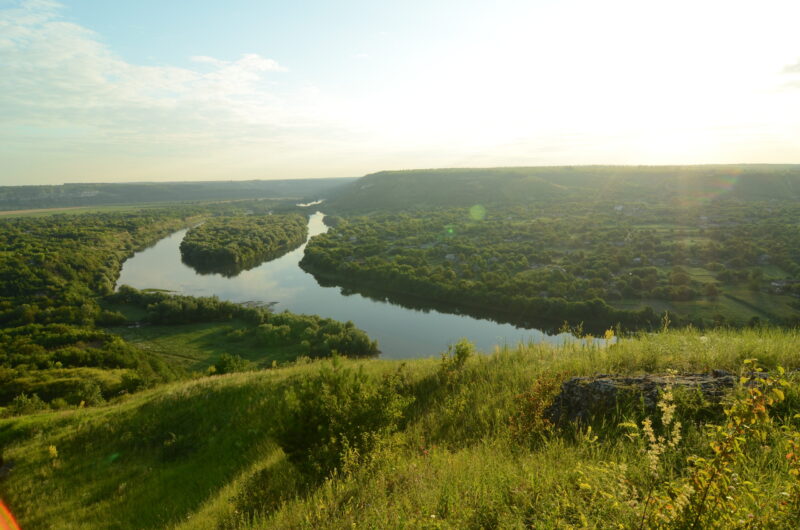
Spanning approximately 700 km in length and averaging 100 km in width, the Dniester Basin takes the form of a highly elongated, curved oval with extended tails. About 20% of the river basin area is in the upper sections, where it intersects with several other basins: the Prut and Tisza in the south, the San (a Vistula tributary) in the west and north, and the Western Bug, Styr, and Horyn (tributaries of the Pripyat River) in the north.
Notably, the hydrographic network of the Dniester Basin is primarily composed of over 14,000 small rivers, each less than 10 km in length. This abundance of smaller streams, contrasted with a scarcity of large tributaries, is a distinctive feature, attributed to the basin’s boundary location relative to other rivers.
The Dniester River is generally categorized into three sections based on its flow, water regime, and physical/geographical characteristics:
- Upper Carpathian Dniester: Extending from the river source to Nizhny Village, including the Tlumach River inflow near the Zolota Lypa River mouth (296 km).
- Middle Podol Dniester: Running from Nizhny Village to Dubasari (715 km).
- Lower Dniester: Stretching from the Dubasari Hydropower Dam to the estuary (351 km).
The river mouth area is distinguished by significant wetland lakes, critical for maintaining water balance and biodiversity in the Dniester Basin. These wetlands offer diverse habitats for migratory birds, mammals, amphibians, and reptiles. Major lakes include Putrino (2.2 km²), Tudorovo (2.8 km²), and Beloe (1.3 km²).
The Dniester Estuary (Liman) is a shallow basin in the river’s wider valley, covering 42 km with a water surface area of 360 km² (or 408 km² when including wetlands) and a volume of 0.54 km³. Separated from the sea by the Bugaz bay-bar (40 to 500 m wide), it connects to the sea through the narrow Tsarehrad Mouth. As Ukraine’s largest freshwater estuary, it plays a significant role in the regional ecosystem.
Land Use and Forests
Land use in the Dniester Basin is dominated by agriculture. About 67% of the Dniester Basin area within Ukraine is agricultural land, which is divided into arable land, perennial plantations, grassland and pastures. The share of arable land is 78% (66% in Ukraine). The Vinnytsia Oblast has the highest proportion of cultivated agricultural land within the whole Dniester Basin. Besides, 23,400 ha and 21,000 ha are occupied by wind breaks and protective forest plantations, respectively.
The average forest coverage in the Dniester Basin within Ukraine is relatively low (14%), and only in the Chernivtsi Oblast do forests occupy about 30% of the total area. (The optimal proportion of forests is at least 30% of the total area). The total area of forest cover within the Ukrainian part of the basin is over 1.2 million ha.
The Dniester Basin area within Moldova is also actively used for agricultural production. Land use in the basin is mainly dominated by arable land, perennial plantations, grassland, and pastures. Within the Moldovan part of the Dniester Basin, 76% of land is used for agriculture, with only 9% being occupied by forests. The largest areas of forests are concentrated around Kodry, where the forest coverage is over 24%. Forests are particularly scarce in the upper section of the Reut River catchment (Balti Steppe) and in southern areas of the left-bank part of the Dniester Basin, where the proportion of forests is below 6%.
Water Reservoirs
Dniester Water Use
The Dniester River has been a cornerstone for various economic activities for centuries, including water transport, water supply, fisheries, and recreation. Since the early 19th century, efforts to modify and maintain the river, such as straightening and clearing the riverbed and deepening rapids, have enhanced its suitability for timber rafting and navigation.
Key Highlights:
- Economic Utilization: The river’s modification since the 19th century has facilitated timber rafting and navigation.
- Hydroelectric Power: The Dniester HPP, a significant industrial entity in the basin, generates approximately 865 million kWh of electricity, mainly during peak hours for the national grid.
- Diverse Use of Water Resources: The Dniester’s water is utilized for irrigation, industrial, municipal, and agricultural purposes. Additionally, the riverbed alluvium is exploited for construction.
- Major Water Users: In Moldova, key cities like Chisinau, Balti, Soroca, Orhei, Ribnita, Dubasari, Tiraspol, and Bender rely on the Dniester. In Ukraine, it supports Lviv, Ivano-Frankivsk, Ternopil, Drohobych, Boryslav, Stryi, Kalush, and Stebnik.
- Water Intakes: Despite its relatively small size, the mouth section of the Dniester in Ukraine hosts major water intakes. The Bilhorod-Dnistrovskyi irrigation system, the Dniester Drinking Water Treatment Plant, and the Mayaki-Bilyaivka and Troitske-Hradenytsi irrigation systems are notable examples. The Dniester Drinking Water Treatment Plant alone draws over 300 million cubic meters of river water annually to supply Odessa.
- Navigation: Navigation on the Dniester is limited, with navigable sections mainly in the Lower Dniester and near Mohyliv-Podilsky in Ukraine.
- Fishing: The river is popular for fishing, especially in the estuary and mouth sections.
Dniester Basin Nature
The ecosystem of the Dniester Basin is mainly represented by forest, steppe and meadow landscapes. The greatest variety of terrestrial plant species remains in the Carpathian part of the Dniester Basin. Its tree species pattern is dominated by spruce and mixed forests, as well as deciduous forests followed downstream by broad-leaved and coniferous forests. These forests mainly consist of oak, beech, hornbeam, and lime-tree. There also occur nut trees, ash trees, and elms.
Steppe vegetation appears further downstream in the basin where it is represented by fescue-feather grass steppes, as well as subpontian-grassland steppes and wormwood-fescue steppes.
Eutrophic, grass-and-moss, shrub and forest wetlands are located in the estuaries of the Dniester tributaries. In the Carpathians, oligo- and mesotrophic wetlands (upstream of the right-bank Carpathian tributaries of the Dniester River) are found occasionally within the basin.
Wetland lakes represent an important feature of the river mouth section. The Dniester wetlands play a vital role in maintaining the water balance and conserving the biological diversity in the Dniester River Basin. They provide varied habitats and rich food base for migratory birds, mammals, amphibias, and reptiles. The largest wetland lakes are Putrino Lake (2.2 km2), Tudorovo Lake (2.8 km2), and Beloe Lake (1.3 km2).
Animal habitats in the most part of the Dniester Basin are in biotopes that have undergone anthropogenic transformation – these are mainly agricultural lands. A significant area of the upper basin is captured within a natural biotope – the dark coniferous (spruce-fir) forests of the Ukrainian Carpathians. Alpine meadows and beech forests of the Ukrainian Carpathians are fragmented in the upper reaches of the Carpathian tributaries.
The most common mammal species in these biotopes are squirrel, red vole, brown bear, pine marten, lynx, red deer, wild cat, European polecat. Local bird species include black stork, golden eagle, booted eagle, Ural owl, common eagle-owl, black woodpecker, nutcracker, hawk, common buzzard, and white-tailed eagle. Reptile communities inhabiting the Dniester Basin comprise common lizard, common European viper, blindworm, Aesculapian snake, while the amphibians include salamander, Carpathian newt, and grass frog.
River floodplains represent a separate biotope. It is possible to come across muskrat, European beaver, Eurasian otter, European mink, and European poleact there. Common bird species include black kite, white-tailed eagle, purple heron, gray goose, common coot, common pheasant, European oystercatcher, black-headed gull, and great reed warbler. Reptile populations that can be encountered there include European pond turtle, emerald lizard, dice snake, common European viper, and Pallas’ coluber.
Nature Reserves
There are three nature reserves within the Moldovan part of the Dniester Basin (Codru, total area – 5,177 ha; Yagorlyk – 836 ha, Plaiul Fagului – 1,562 ha), and also the first National Park Orhei (total area – 33,792 ha).
The Moldovan part of the Dniester Basin includes two Ramsar sites: the Lower Dniester (60,000 ha) and Unguri-Holosnita (15,553 ha).
There are six national parks established in the Dniester basin within Ukraine: Halych National Nature Park (14,685 ha); Lower Dniester National Nature Park (21,311 ha), Medobory (Podilski Tovtry, 2,613 ha); Skole Beskids (35,684 ha); Khotyn National Natural Park (9,446 ha); and Dniester Canyon National Nature Park (10,829 ha).
The Ramsar wetlands within the Ukrainian part of the Dniester Basin are the Bakota Bay, the Dniester-Turunchuk Crossrivers Area (Dniester floodplains), and the northern part of the Dniester Estuary (Liman).
Issues
Today, the Dniester River Basin is facing serious environmental challenges, including flow control, pollution, biodiversity loss, climate change, and resource management.
FAQs
What is the historical significance of the Dniester River?
Explore the Dniester River’s role in historical events and its cultural importance to the regions it flows through.
How does climate change impact the Dniester Basin?
Understand the effects of global warming on the river’s ecosystem, water levels, and surrounding communities.
What are the initiatives for sustainable management of the Dniester Basin?
Discover the various conservation and management programs aimed at preserving the Dniester River’s health and biodiversity.
What kind of recreational activities can be enjoyed in the Dniester Basin?
A guide to leisure activities like boating, fishing, and nature tours in the Dniester Basin region.
How does the Dniester River influence the local climate?
Learn about the Dniester’s role in shaping the climate and weather patterns in its surrounding areas.
Are there any unique cultural practices or traditions linked to the Dniester River?
Explore the traditions, folklore, and local customs that have evolved around the Dniester River over centuries.
What are the major environmental threats to the Dniester River’s wildlife?
Investigate the key challenges and threats facing the wildlife and habitats within the Dniester River Basin.
Conclusion
In summary, the Dniester River Basin is not just a geographical feature but a lifeline for the regions it traverses. Its impact on population centers, economic activities, and the natural environment underscores its multifaceted importance. While it offers abundant resources, from water for millions to diverse industrial applications, it also presents significant environmental challenges that demand immediate attention. The basin’s rich biodiversity, scenic landscapes, and valuable wetlands require concerted conservation efforts to preserve their beauty and ecological function.