Floodplains are naturally occurring geographical features that play a vital role in the ecosystem. These low-lying areas adjacent to rivers and streams are subject to periodic flooding, a phenomenon that has shaped human civilization and the natural world for millennia.
Floodplains are formed through a dynamic process involving water movement, sediment transport, and ecological interactions. The development of a floodplain is intrinsically linked to the river and tributaries it borders; as the river meanders, erodes, and deposits sediment, it gradually shapes the surrounding land into a floodplain.
Formation & Evolution of Floodplains
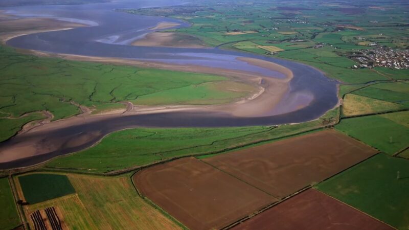
The formation of a floodplain is a gradual, yet powerful process governed by the natural dynamics of rivers. When a river overflows its banks, it spreads out over the adjacent land, depositing sediment and nutrients.
Over time, these deposits build up, creating the flat, often fertile lands that characterize floodplains. The process of deposition and erosion is not uniform, leading to a varied topography within the floodplain, including features like levees, oxbow lakes, and backswamps.
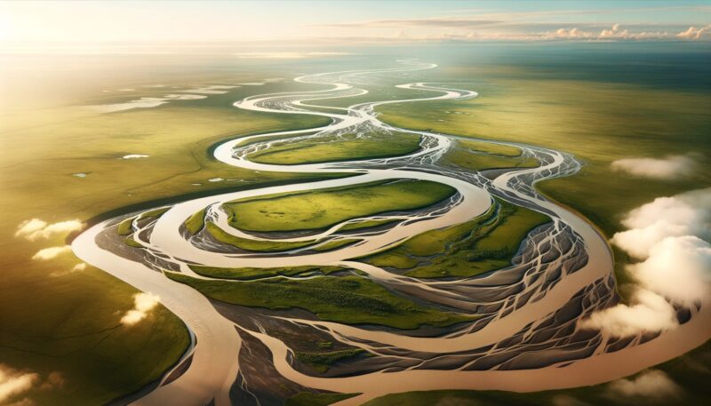
One key aspect of floodplain evolution is the concept of channel migration. Rivers are not static; they move and change course over time.
This movement is particularly evident in meandering rivers, where erosion occurs on the outer bends and deposition on the inner bends, causing the river to snake across the floodplain. This ongoing process reshapes the floodplain, influencing its ecological and physical characteristics.
The Hydrology of Floodplains
Floodplains are shaped by the ebb and flow of water, a cycle that is both predictable and erratic. The frequency, duration, and intensity of flooding events determine the nature of a floodplain.
Factors such as rainfall patterns, snowmelt, topography, and the river’s watershed characteristics influence these flooding events. Floodplains play a significant role in the hydrological cycle by acting as natural water storage areas.
During periods of heavy rainfall or snowmelt, floodplains absorb excess water, reducing the risk of downstream flooding. This capacity to store water also helps during dry periods, as water slowly seeps back into the river, maintaining flow levels.
Ecological Significance of Floodplains
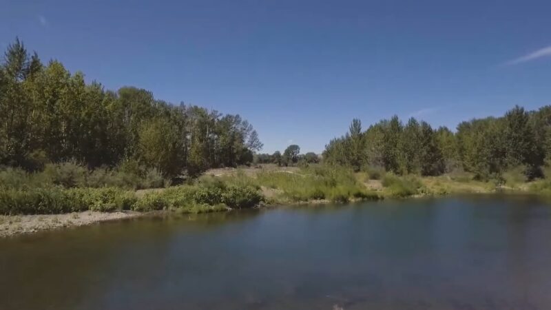
The ecological significance of floodplains cannot be overstated. These areas are among the most productive and biologically diverse ecosystems on the planet.
The regular flooding regime brings nutrients, which makes floodplain soils highly fertile and supports a diverse array of plant and animal species. Floodplains offer critical habitat for many species, including fish, birds, and mammals.
For aquatic species, floodplains provide important breeding and feeding grounds. Many fish species depend on the shallow, warm waters of flooded areas for spawning.
Birds, too, thrive in these environments, with many species relying on floodplain habitats for nesting and foraging. Additionally, the diversity of plant life in floodplains supports a wide range of terrestrial animals, creating a complex and interconnected ecosystem.
Human Interaction with Floodplains
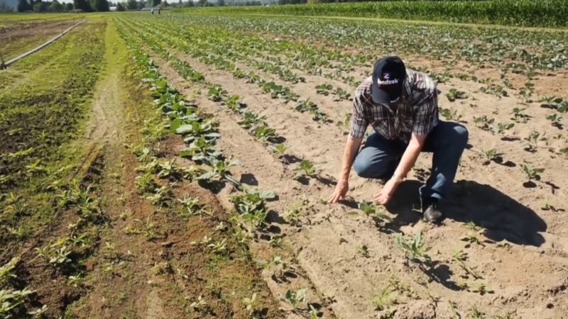
The relationship between humans and floodplains is a story of both harmony and conflict. Historically, floodplains have been centers of human civilization, providing fertile land for agriculture and access to waterways for transportation and trade.
Many of the world’s oldest and most prosperous cities were established on floodplains. However, living in floodplains comes with risks.
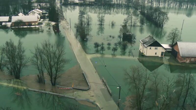
Flooding, a natural and essential process for the health of the floodplain, can also be a source of disaster for human settlements. In modern times, the management of floodplains has become a significant challenge.
Urban development, agriculture, and the construction of dams and levees have altered natural floodplain dynamics, often with detrimental effects. These changes can lead to increased flooding risk, loss of habitat, and diminished ecological function.
Balancing the needs of human development with the preservation and restoration of natural floodplain functions is a key challenge for environmental management and policy.
Conservation and Management of Floodplains
The conservation and management of floodplains are critical for both ecological health and human welfare. Efforts to preserve and restore floodplains focus on maintaining their natural functions, such as flood mitigation, habitat provision, and water quality improvement.
Strategies include the restoration of meanders in channelized rivers, the reconnection of rivers with their floodplains, and the establishment of protected areas.
| Management/Conservation Strategy | Description |
|---|---|
| Restoration of Meanders | Reinstating natural curves in straightened rivers to restore natural flow and sediment patterns. |
| Reconnection of Rivers and Floodplains | Allowing rivers to flood naturally to restore ecological processes and habitat connectivity. |
| Establishment of Protected Areas | Designating areas as protected to preserve natural floodplain functions and biodiversity. |
| Limiting Development in Flood-Prone Areas | Restricting construction and urban development in areas susceptible to flooding. |
| Implementing Flood-Friendly Agricultural Practices | Adopting agricultural methods that minimize flood damage and maintain natural floodplain functions. |
| Designing Flood-Accommodating Infrastructure | Building structures that can withstand flooding and do not impede natural water flow. |
| Formulating Public Policy and Planning | Developing policies and plans that balance environmental preservation with human needs and safety. |
Effective floodplain management also involves sustainable land-use practices. This includes limiting development in flood-prone areas, implementing flood-friendly agricultural practices, and designing infrastructure that accommodates natural flooding processes.
Public policy and planning play crucial roles in these efforts, requiring a balance between economic development, human safety, and environmental preservation.
FAQs
Can floodplains help in improving water quality in rivers?
Yes, floodplains can significantly improve water quality. When floodwaters spread over a floodplain, the slower movement allows sediments and pollutants to settle out. Additionally, floodplain vegetation acts as a natural filter, absorbing and breaking down pollutants. This process reduces the load of sediments and contaminants entering the river, thereby improving water quality.
How do floodplains affect the local climate?
Floodplains can influence local climate conditions, primarily through their effects on humidity and temperature. The presence of water bodies and moist soil in floodplains increases humidity in the surrounding area. Additionally, the vegetation in floodplains can help moderate temperatures, often making the local climate slightly cooler than surrounding areas. This microclimate effect can be particularly noticeable in urban areas with nearby floodplains.
Are floodplains only found along rivers?
While most commonly associated with rivers, floodplains can also form along other bodies of water such as lakes, estuaries, and even occasionally along coasts. In these settings, similar processes of sediment deposition and periodic flooding create flat areas that are subject to inundation.
What is the difference between a floodplain and a wetland?
Floodplains and wetlands are both ecosystems that involve water, but they have distinct characteristics. A floodplain is specifically the area adjacent to a river or stream that is periodically flooded. In contrast, a wetland is an area where water covers the soil or is present either at or near the surface of the soil all year or for varying periods of time during the year, including during the growing season. Wetlands are not necessarily associated with rivers and can include marshes, swamps, and bogs.
Can floodplains be used for agriculture?
Yes, floodplains can be highly productive agricultural areas due to their fertile soils enriched by sediment deposits from floods. However, farming in floodplains requires careful management to mitigate the risks of flood damage and to ensure that agricultural practices do not adversely impact the floodplain’s ecological functions.
How do floodplains impact the carbon cycle?
Floodplains play a significant role in the carbon cycle. They act as carbon sinks, storing carbon in their vegetation and soil. The periodic flooding introduces organic matter, which is broken down by microbes, either releasing carbon back into the atmosphere or further contributing to soil carbon storage. This process helps regulate atmospheric carbon dioxide levels and can mitigate the effects of climate change.
Final Words
Floodplains are dynamic landscapes that play a crucial role in the natural world and human society. Their formation, hydrology, and ecology are intricately linked to the rivers that create and sustain them.
Floodplains provide vital ecosystem services, support diverse biological communities, and have been central to human civilization for thousands of years. However, the management of these areas presents complex challenges, requiring careful balancing of ecological needs and human demands.
As we move forward, the conservation and sustainable management of floodplains will be essential for preserving their ecological functions and supporting the well-being of future generations.